Weather, Gliders, and Clouds
When thinking about density altitude and performance vs. mountain weather, the issue is really “What do we have to work with?” vs. “What are we up against?” Being glider-rated, it seems obvious to use soaring techniques to gain advantage in the mountains. In my neighborhood, the eastern Sierra Nevada Mountains, glider pilots are able to keep their craft aloft for hours and cover hundreds of miles on a good day. In similar geographic locales, “power” pilots should be able to use the same techniques to be not only safer, but more efficient mountain pilots.
The Up- and Downsides to Thermal Lift
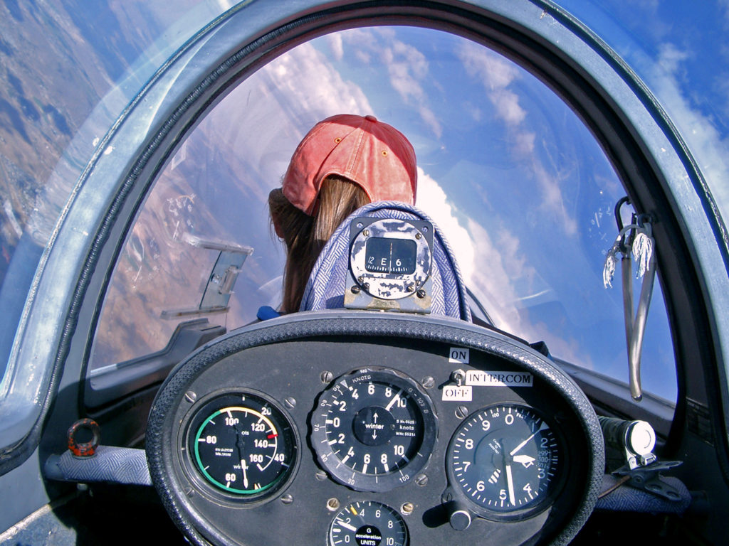
Mountain weather by itself is worthy of an extended discussion—this part of the series will primarily consider weather phenomena relating to vertical convection. In most areas, including the flatlands, vertical convection is most commonly the result of differential heating of the earth’s surface. This differential heating can create rising columns of air sometimes topped by afternoon cumulus clouds. Glider pilots use these “thermals” to stay aloft and perform cross countries during the warmer months. In the photo below, the glider is being maneuvered in a tight turn in order to circle (and loiter) within a rising column of air. Doing so allows the glider to gain altitude: note that the glider’s rate of climb (center instrument) is nearly 1,000 feet per minute at 12,500 MSL.
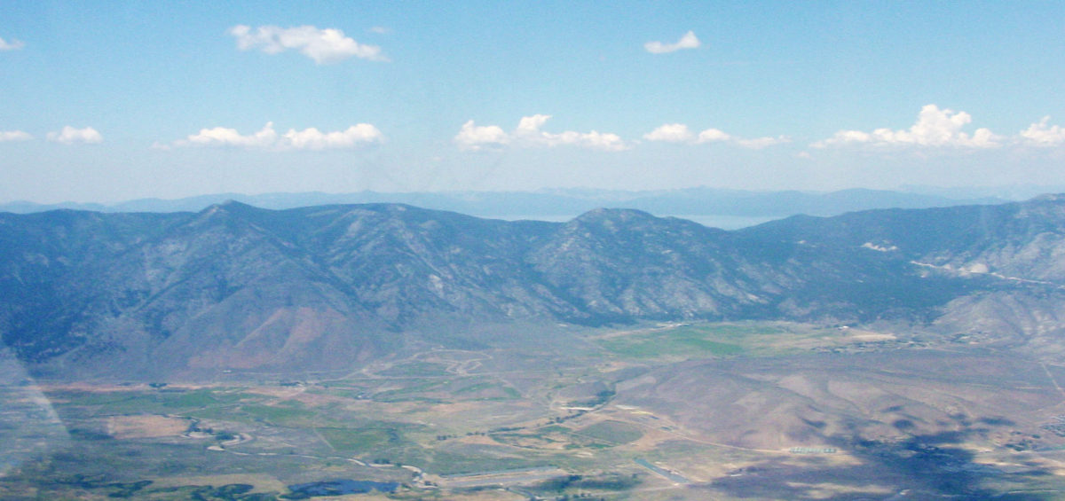
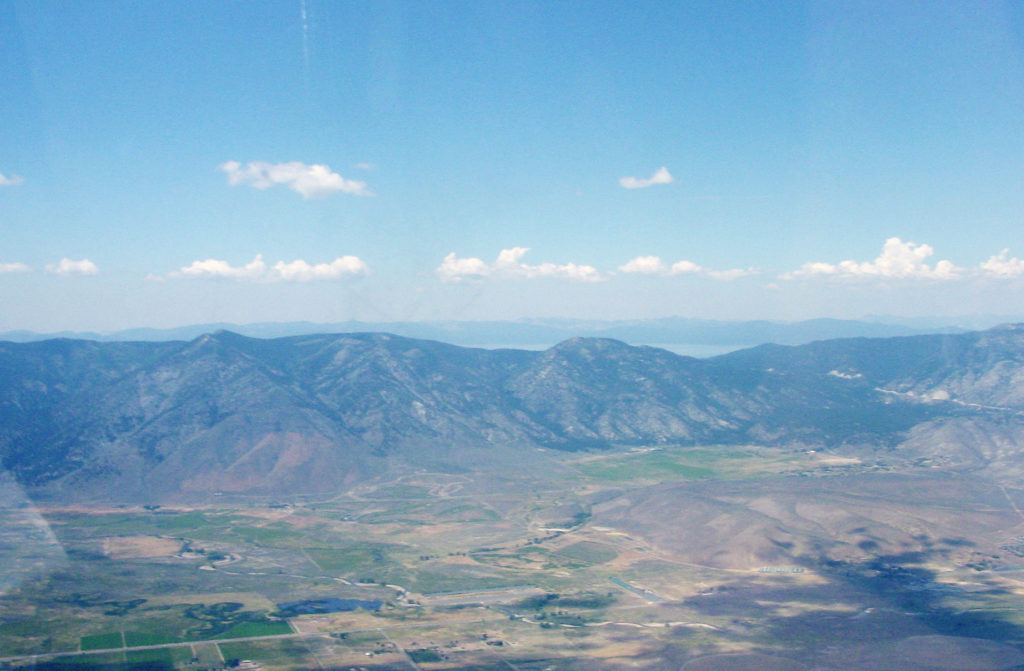
As the photo demonstrates, mountain thermals can be quite robust. They can also be predictable: for example, the eastern-facing slopes are the first to receive sunshine in the morning, commonly long before the valley floor. It stands to reason, then, that the eastern-facing slopes are good places to look for thermal activity, at least early in the day. In the photograph below, taken late in the morning, a line of budding cumulus clouds marks the beginnings of thermal activity along the eastern-facing ridgeline at Lake Tahoe.
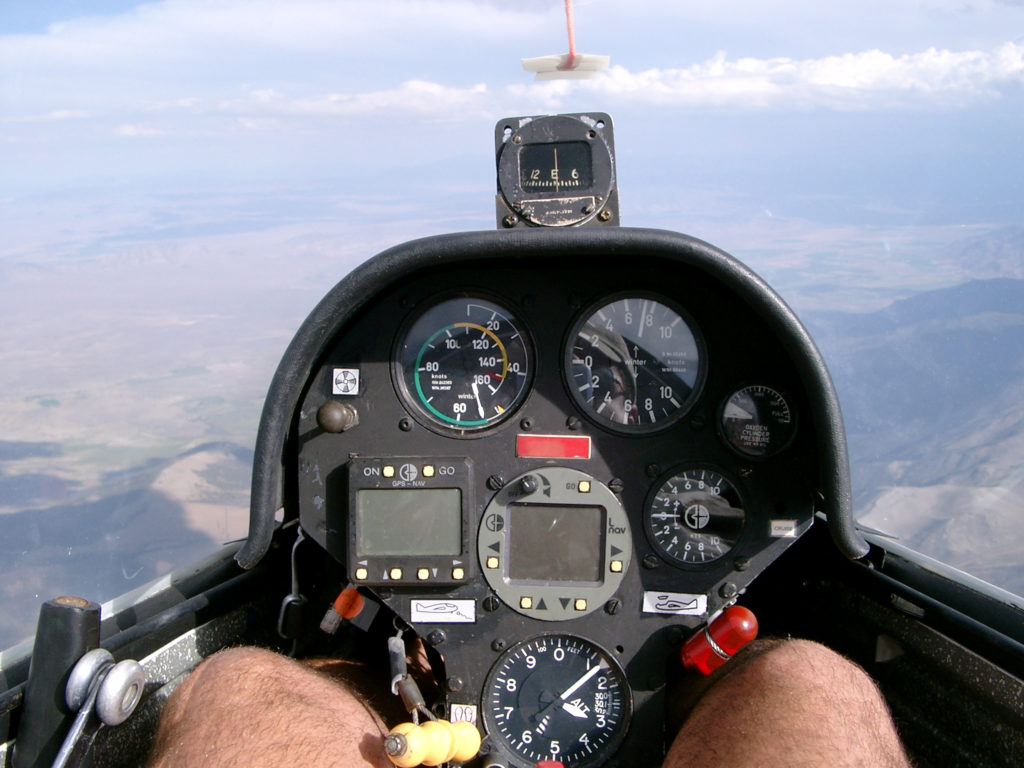
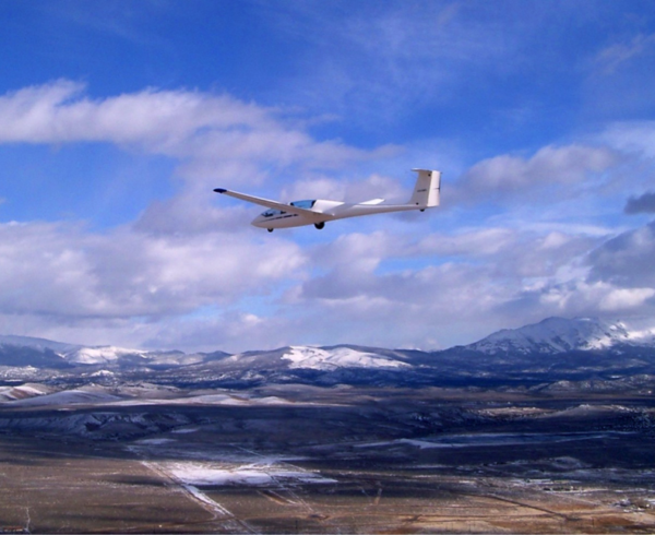
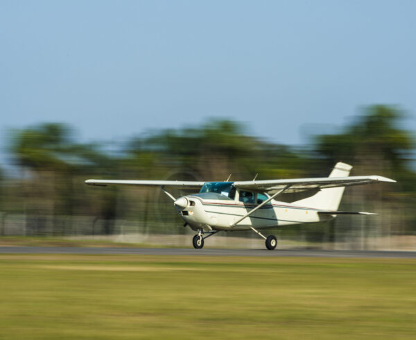
Lines, or “streets,” of thermals are quite common. In the photo below, the glider is wings-level beneath a “street” of cumulus clouds in the Smith Valley, east of Minden, NV (KMEV). The glider is climbing through 13,000 feet at a rate of climb near 800 feet per minute (instrument upper right). Your Piper Arrow, in still air, climbs at less than 300 feet per minute at this altitude. Wouldn’t it be great to add 800 feet per minute to your climb rate?
Given the performance capabilities of the typical light GA aircraft in the mountain environment, getting a 500-1,000 foot per minute boost would make a big difference in the aircraft’s total time-to-climb. More importantly, where there is lifting air, there is also sinking air, so beware: a 500-1,000 foot per minute downdraft is far more than your Piper Arrow can compete with. We’ll revisit this scenario when we discuss speed-to-fly.
The bottom line with thermals is that they’re parcels of rising air—turbulent rising air. So even though thermals can boost performance, passengers may find them uncomfortable because of the resulting turbulence. Best practice in avoiding the worst convection and turbulence is to fly early, give your passengers a smooth ride, and wait out the worst of the afternoon’s turbulence.. Many areas have a “Soaring Forecast” that contains useful information on atmospheric stability, moisture content, and thunderstorm potential—along with useful info like “trigger temperature” and trigger time. At trigger time, thermal strength of 260 feet per minute can be expected to rise to 4,000 feet AGL. In other words, trigger time is the point in the day when the strength of updrafts and downdrafts will begin to rival your light aircraft’s performance—useful information indeed.
May the force—of mechanical lift—be with you
Unlike the flatlands, the mountains have mechanical deflection as another major source of vertical convection: imagine water flowing over rocks in a stream. When the winds aloft pick up, the mountain ridges deflect them, giving rise to convection and turbulence. If the atmosphere is unstable, the result could be orographic thunderstorms. Stable atmospheres give rise to other types of convection. Make note that one knot is approximately 6,000 feet per 60 minutes, or 100 feet per minute. Therefore if we were able to deflect even a light 5-knot breeze straight up, it would be a 500-foot per minute updraft. For this reason, it’s good advice to take the winds aloft over the ridgelines seriously. More realistically, if we deflect a horizontal wind up (or down) at a 45 degree angle, its vertical component will be approximately 70% of the total velocity. For example, a 10-knot breeze over the ridgeline turns into a 700 foot per minute downdraft in the immediate vicinity of the ridge if it’s deflected down at a 45 degree angle. The aircraft’s crab angle in the vicinity of the ridge will provide a clue as to what the winds are up to: expect lifting air on the windward side of the ridge and sinking air on the leeward side.
Surfing the Mountain Wave
When conditions are right, a standing wave will form downwind from the ridgeline. Mountain wave can be thought of as ridge lift’s “muscular cousin.” The “right conditions” begin with at least a 15-knot wind nearly perpendicular to the ridge. The direction of the winds aloft should be nearly constant with altitude—atypical due to the Coriolis Effect. The wind velocity should increase with altitude—a speed gradient. Finally, the atmosphere should contain a stable layer of air sandwiched between two “less stable” layers. This is analogous to a stiff spring sandwiched between two “less stiff” springs: if you whack the three-spring system and set it in motion, eventually it settles into a steady state in which the stiff spring barely flexes at all while bouncing back and forth between the looser springs.
Beware of Cloud “Baguettes”
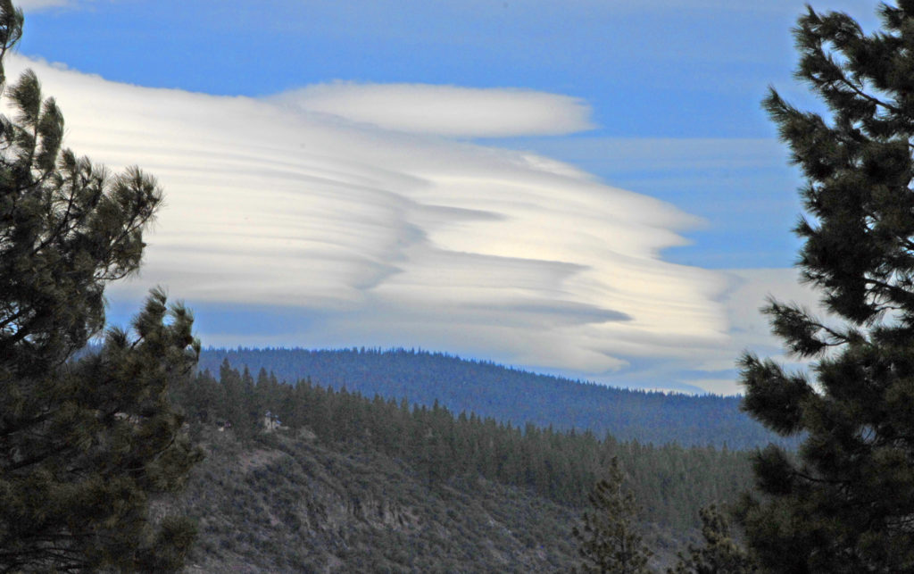
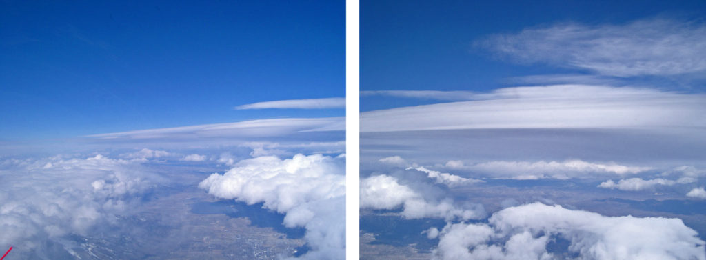
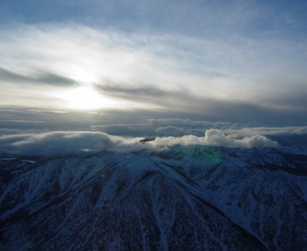
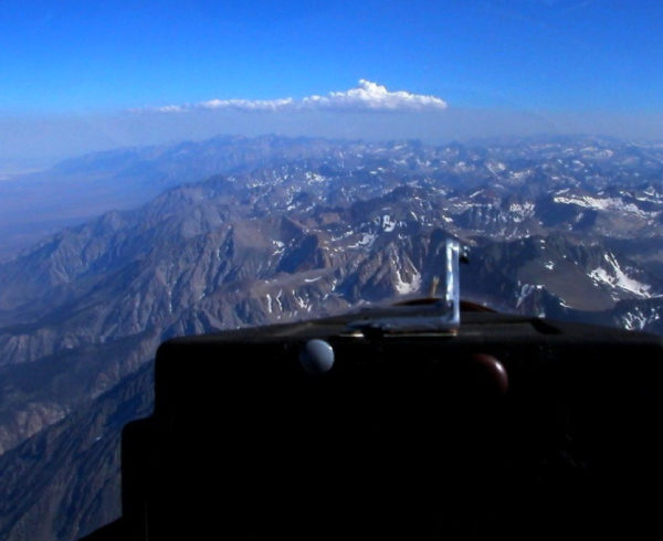
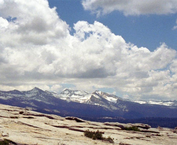
The crest of the mountain wave is often marked with altocumulus standing lenticular clouds, provided there’s sufficient moisture. These clouds don’t necessarily mark conditions of greatest lift, just areas of sufficient moisture. At the lower levels, moisture may condense on its ascent, blanketing the ridgeline with a cap cloud. After cresting the ridge, the air descends (of course) and commonly dries out, resulting in what’s called a foehn gap. Further downwind is the rotor zone: rotor clouds mark turbulent eddies being shed by the ridgeline. These clouds often parallel the ridgeline like a giant loaf of French bread and may indicate severe turbulence. This pair of photos below shows a classic wave system, with the winds aloft blowing from left to right.
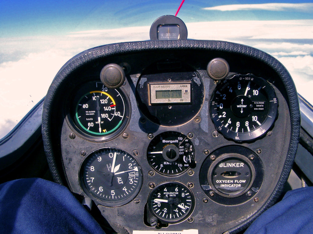
Mountain waves contain tremendous amounts of energy and often extend well into the flight levels. The upper levels are very smooth, but the lower levels (near ridge level) often contain dangerous turbulence. Best practice is for the light-aircraft pilot to steer clear of a mountain wave, unless armed with a lot of experience and instruction. In the photo below, a glider is climbing through 21,000 feet MSL on an altitude flight in a mountain wave—the rate of climb (upper right) is approximately 800 feet per minute. The lesson here is, the vertical convection in mountain waves is not to be trifled with.
Mastering the Art of Soaring
I’ve learned that most power pilots are uninformed about the glider world. I’ve run across so many who think that flying a glider consists of launching behind a tow plane, climbing to altitude, releasing, and gliding back to the airport. That’s a dangerous oversimplification. “Soaring” is a sport that hones a pilot’s ability to read and use the weather effectively. The object of the sport is to keep the glider aloft using vertical convection to the pilot’s advantage—and mastering that takes a lot of skill. Power pilots can and should use knowledge and techniques to take advantage of the weather, same as glider pilots do.
In the next installment of this series, we will leverage our knowledge of mountain weather and discuss rules to operate by in the mountains; we’ll also discuss the glider concept “speed to fly.”



Excellent series. Looking forward to reading the next two episodes.